Wang Yu
Master Student
Remote Sensing Science and Technology
Wuhan University
Email: wangfaye@whu.edu.cn
Google Scholar: Link
Github: vvangfaye
CV: [EN]
Experience
I am a third-year Master’s student in the School of Remote Sensing and Information Engineering at Wuhan University, advised by Prof. Yansheng Li. I hold a Bachelor of Engineering degree from the same university.
Currently, I am a research intern at Amap ML Group, focusing on urban multimodal understanding. I have also completed research/engineering projects at Ant Group and several Surveying and Mapping Institutes.
Publication
Urban Socio-Semantic Segmentation with Vision-Language Reasoning
Yu Wang, Yi Wang, Rui Dai, Yujie Wang, Kaikui Liu, Xiangxiang Chu, Yansheng Li*
International Conference on Learning Representations (ICLR), 2026
[project page] [paper] [code]
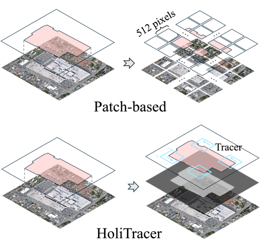
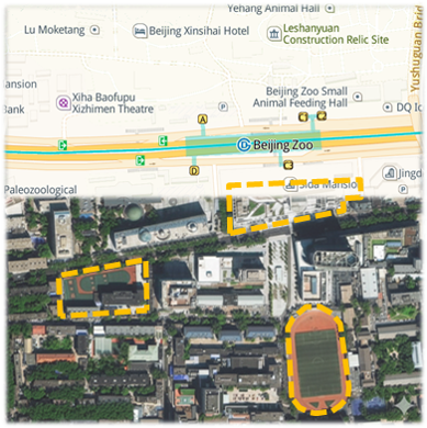
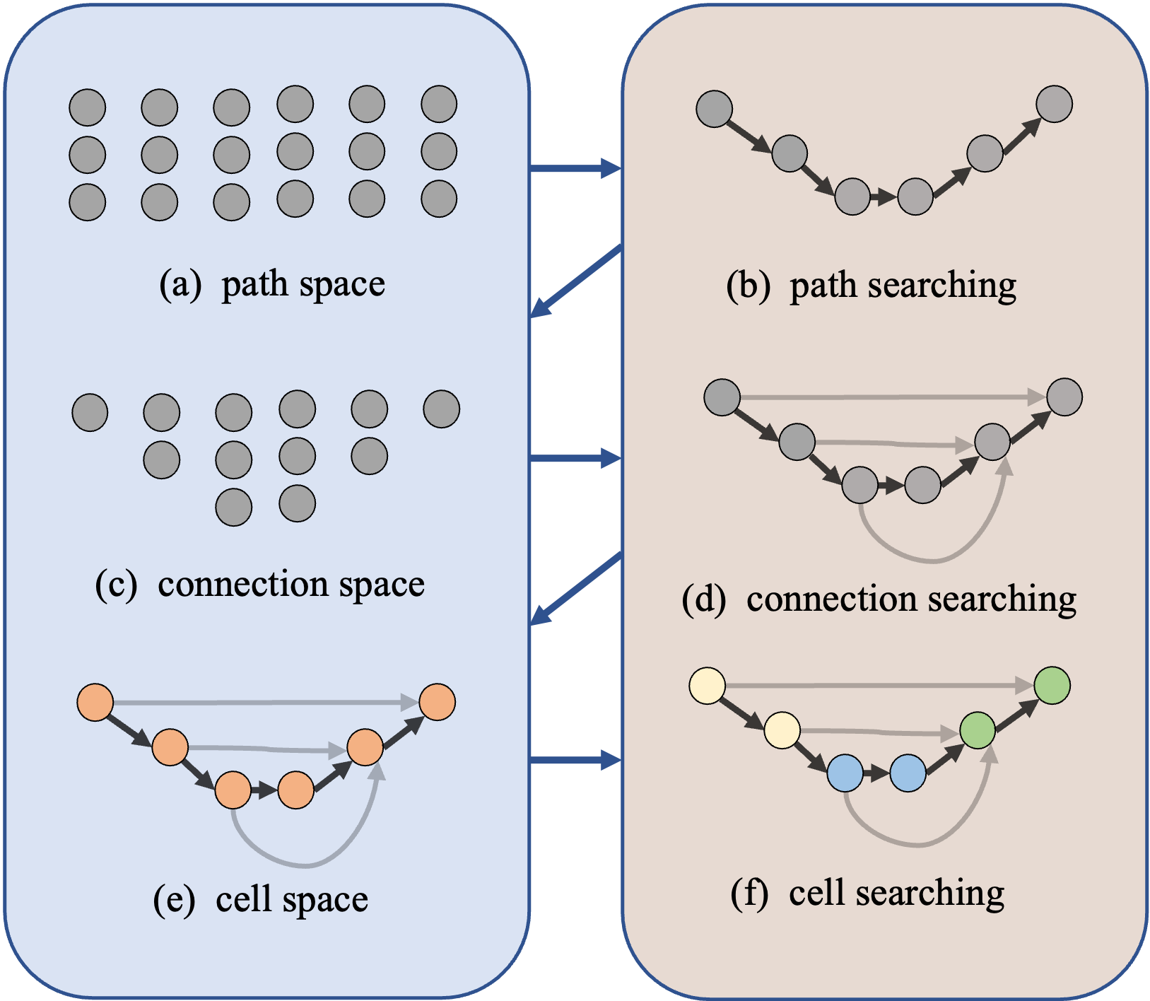
HoliTracer: Holistic Vectorization of Geographic Objects from Large-Size Remote Sensing Imagery
Yu Wang, Bo Dang, Wanchun Li, Wei Chen, Yansheng Li*
International Conference on Computer Vision (ICCV), 2025
[project page] [paper] [code]
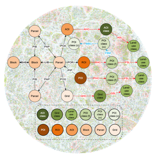
Learning to Reason over Multi-Granularity Knowledge Graph for Zero-Shot Urban Land-Use Mapping
Yansheng Li, Yu Wang*, Lei Yu, Bo Dang, Gang Xu, Zhenyu Zhong, Yuning Wu, Xin Guo, Kang Wu, Zheng Li, Linlin Wang, Jian Wang, Jingdong Chen, Ming Yang, Yongjun Zhang*
Remote Sensing of Environment (RSE), 2025
[project page] [paper] [code]
Project
EarthVec (python toolikit)
Integrate satellite imagery vectorization datasets and methods.
[code]
Geo2Graph (web app)
Text/Image/Shape to graph representation, including data and algorithm’s visilazation.
[code]
珞-Sky (web app)
Online interpretation of satellite imagery, supporting multiple tasks.
Second Prize in 11th China Software Cup, 2022